Event created by Russell D - 1104622
Event Details
Simulation Date/Time : Current date set to daylight.
Weather : Real World / Fair weather if real world is unsuitable for VFR operations.
Distance : 240 nm
Est Flight Time : approx 80 mins
Aircraft : Single or twin engine turbine aircraft such as Beechcraft King Air, Pilatus PC-12 or similar capable of 200 to 240 kias.
Communications :vAustralia uses CTAF (Common Traffic Advisory Frequency) for radio comms at uncontrolled airfields. VATSIM pilots connecting to the network using FSCOPILOT/FSINN can install an additional file that provides the ability to tune the CTAF frequency and make voice announcements to other pilots on frequency. These files can be obtained via this link.
Altitude : Once clear of Darwin, remain below class C steps.
Flightplan
File as : YPDN LPT VFR.ROUTE.2 CTT LFS YOEN YGBI YMIJ YCKI
Navigation : Pilots familiar with the area can navigate visually, for those less familiar the accompanying GPS Flightplan is the recommended method of navigating the flight plan.
GPS Flightplan is available for FSX, FS9 and X-Plan FMS and also provided is the original Plan-G flightplan for those that find this useful all enclosed within a Zip archive.
Recommended Scenery
Flight Details
-
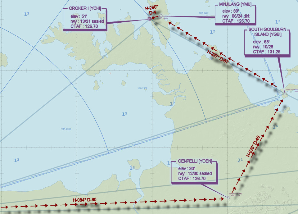
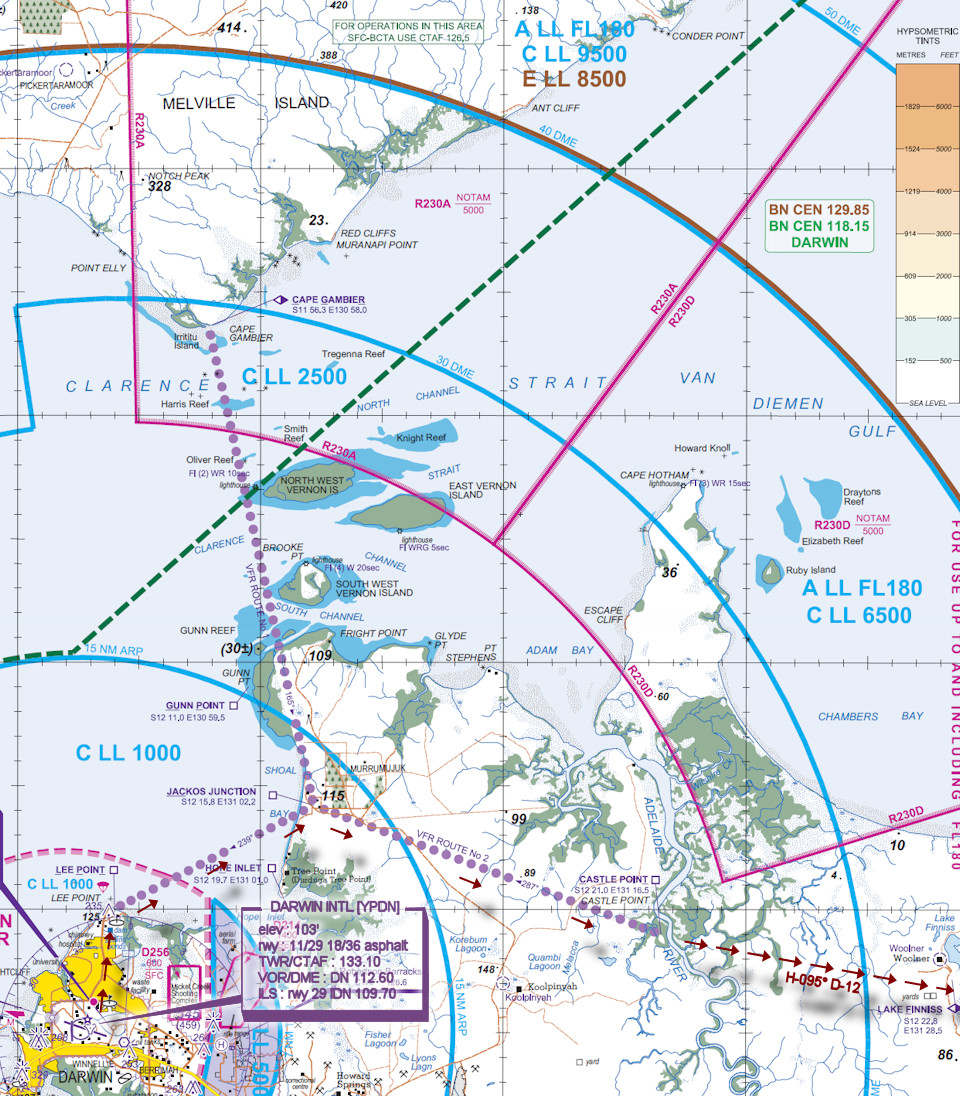
DARWIN INTL [YPDN] Takeoff
elev : 103'
rwy : 11/29 18/36 asphalt
TWR/CTAF : 133.10
VOR/DME : DN 112.60
ILS : rwy 29 IDN 109.70 -
LEE POINT [LPT] Overfly - H-012° D-5
-
JACKOS JUNCTION [JAC] Overfly - H-058° D-9
-
CASTLE POINT [CTT] Overfly - H-107° D-15
-
LAKE FINNISS [LFS] Overfly - H-095° D-12
-
OENPELLI [YOEN] T&G - H-084° D-90
elev : 30'
rwy : 12/30 sealed
CTAF : 126.70 -
SOUTH GOULBURN ISLAND [YGBI] T&G - H-025° D-46
elev : 63'
rwy : 10/28
CTAF : 131.25 -
MINJILANG [YMIJ] T&G - H-297° D-57
elev : 39'
rwy : 06/24 dirt
CTAF : 126.70 -
CROKER I [YCKI] Land - H-260° D-4
elev : 51'
rwy : 13/31 sealed
CTAF : 126.70
Darwin VTC
WAN Chart