Event created by Russell D - 1104622

Event Details
Simulation Date/Time : Current date set to daylight.
Weather : Real World / Fair weather if real world is unsuitable for VFR operations.
Distance : 173 nm
Est Flight Time : approx 85 mins
Aircraft : Single or twin engine such as Mooney Bravo, Beechcraft Baron or similar capable of 145 to 175 kias.
Communications : Australia uses CTAF (Common Traffic Advisory Frequency) for radio comms at uncontrolled airfields. VATSIM pilots connecting to the network using FSCOPILOT/FSINN can install an additional file that provides the ability to tune the CTAF frequency and make voice announcements to other pilots on frequency. These files can be obtained via this link.
For pilots connecting to VATSIM using VPilot, there is a work around that enables these pilots to also take advantage of online voice CTAF. Refer to this informative VATPAC Forum post to learn how to implement the work around.
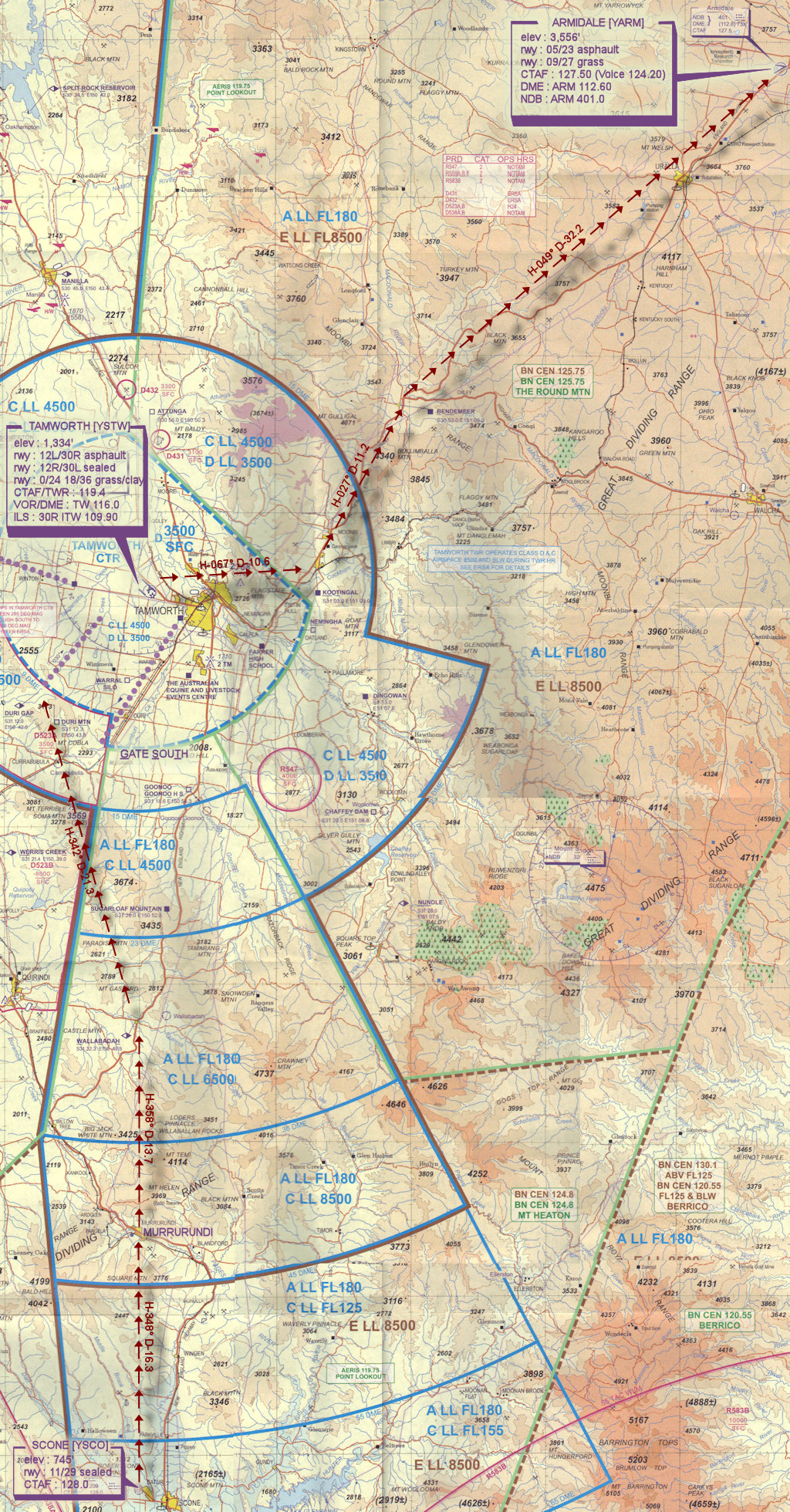
Altitude : Remain below Tamworth Class D steps upto 9500
Flightplan
File as : YCNK YSGT YJYP YSCO MUI WBH DUA YSTW KOT BND YARM
GPS Flightplan is available for FSX and X-Plane FMS and also provided is the original Plan-G flightplan for those that find this useful all enclosed within a Zip archive.
Navigation : Pilots familiar with the area can navigate visually, for those less familiar the accompanying GPS Flightplan is the recommended method of navigating the flight plan.
Recommended Scenery
Flight Details
-
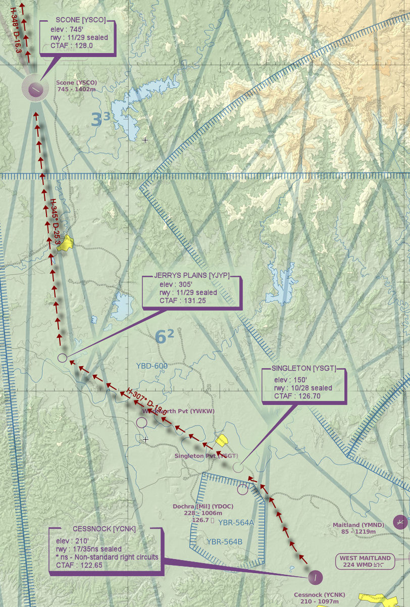
CESSNOCK [YCNK] Takeoff
elev : 210'
rwy : 17/35ns sealed
* ns - Non-standard right circuits
CTAF : 122.65
-
SINGLETON AIRFIELD [YSGT] T&G - H-314° D-13.4
elev : 150'
rwy : 10/28 sealed
CTAF : 126.70
-
JERRYS PLAINS (COOLMORE) [YJYP] T&G - H-307° D-19.0
elev : 305'
rwy : 11/29 sealed
CTAF : 131.25
-
SCONE [YSCO] T&G - H-345° D-25.3
elev : 745'
rwy : 11/29 sealed
CTAF : 128.0
-
MURRURUNDI [MUI] Overfly - H-348° D-16.3
-
WALLABADAH [WBH] Overfly - H-358° D-13.7
-
DURI GAP [DUA] Overfly - H-342° D-21.3
-
TAMWORTH [YSTW] T&G - H-047° D-10.3
elev : 1,334'
rwy : 12L/30R asphault
rwy : 12R/30L sealed
rwy : 0/24 18/36 grass/clay
CTAF/TWR : 119.4
VOR/DME : TW 116.0
ILS : 30R ITW 109.90
-
KOOTINGAL [KOT] Overfly - H-067° D-10.6
-
BENDEMEER [BND] Overfly - H-027° D-11.2
-
ARMIDALE [YARM] Land - H-049° D-32.2
elev : 3,556'
rwy : 05/23 asphault
rwy : 09/27 grass
CTAF : 127.50
DME : ARM 112.60
NDB : ARM 401.0
Cessnock to Scone WAN Chart
Tamworth VTC