Event created by Russell D - 1104622

Simulation Date/Time : Current date set to daylight.
Weather : Real World / Fair weather if real world is unsuitable for VFR operations.
Distance : 235 nm
Est Flight Time : approx 80 mins
Aircraft : Single or twin engine aircraft such as PC-12, Beechcraft King Air or similar capable of 185 to 225 kias.
Communications : Australia uses CTAF (Common Traffic Advisory Frequency) for radio comms at uncontrolled airfields. VATSIM pilots connecting to the network using FSCOPILOT/FSINN can install an additional file that provides the ability to tune the CTAF frequency and make voice announcements to other pilots on frequency. These files can be obtained via this link.
For pilots connecting to VATSIM using VPilot, there is a work around that enables these pilots to also take advantage of online voice CTAF. Refer to this informative VATPAC Forum post to learn how to implement the work around.
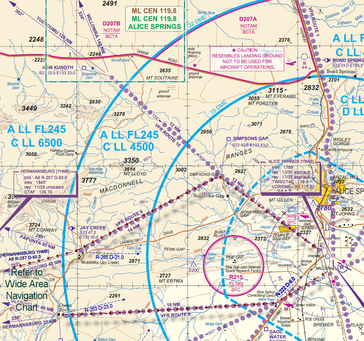
Altitude : Once clear of Alice Springs Class C remain below the steps not above FL125
Flightplan
File as : YBAS YHMB YHAA YPAY YLBG YYND
GPS Flightplan is available for FSX and X-Plane FMS and also provided is the original Plan-G flightplan for those that find this useful all enclosed within a Zip archive.
Navigation : Pilots familiar with the area can navigate visually, for those less familiar the accompanying GPS Flightplan is the recommended method of navigating the flight plan.
Recommended Scenery
Flight Details
-
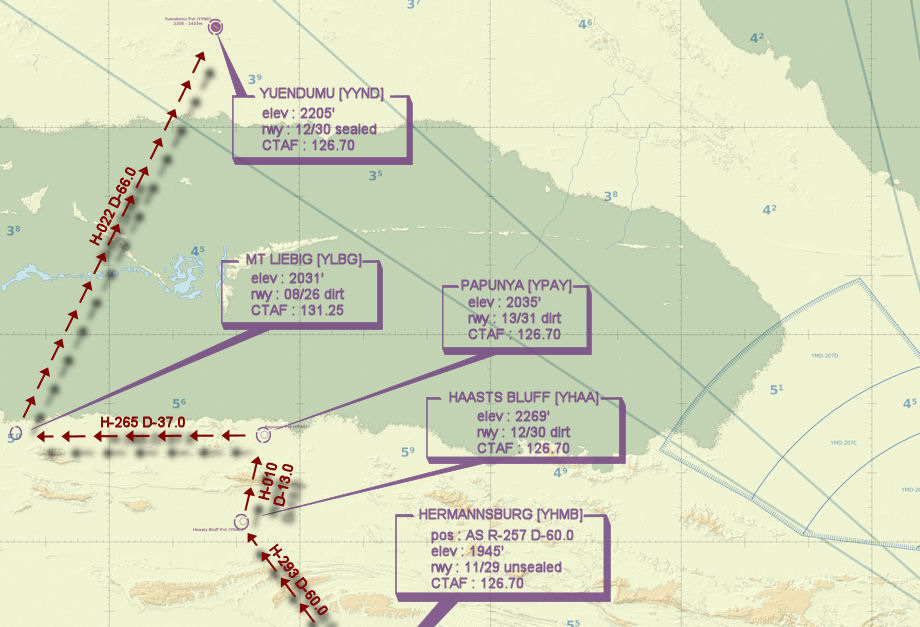
ALICE SPRINGS [YBAS] Takeoff
elev : 1789
rwy : 17/35 12/30 asphalt
CTAF : 118.30
VOR/DME : AS ALICE SPRINGS 115.90
NDB : AS ALICE SPRINGS 335.0
Note : Pilots can choose to depart Alice Springs via either VFR Route 8 or VFR Route 9 at their discretion. Advice ATC of the desired departure if ATC is active. -
HERMANNSBURG [YHMB] T&G - H-258° D-60.6 nm
elev : 1945
rwy : 11/29 gravel
CTAF : 126.70 -
HAAST'S BLUFF [YHAA] T&G - H-293° D-59.7 nm
elev : 2969
rwy : 12/30 dirt
CTAF : 126.70 -
PAPUNYA [YPAY] T&G - H-010° D-13 nm
elev : 2035
rwy : 13/31 dirt
CTAF : 126.70 -
MT LIEBIG [YLBG] T&G - H-265° D-35.7 nm
elev : 2067
rwy : 08/26 dirt
CTAF : 131.25 -
YUENDUMU [YYND] Land - H-022° D-66 nm
elev : 2204
rwy : 12/30 asphalt
CTAF : 126.70
Alice Springs VTC
Alice Springs to Yuendumu WAN