Event created by Russell D - 1104622

Event Details
Simulation Date/Time : Current date set to daylight.
Weather : Real World / Fair weather if real world is unsuitable for VFR operations.
Distance : 151 nm
Est Flight Time : approx 85 mins
Aircraft : Single or twin engine aircraft such as Beechcraft Baron, Cessna Caravan, Mooney Bravo or similar capable of 155 to 185 kias.
Communications : Australia uses CTAF (Common Traffic Advisory Frequency) for radio comms at uncontrolled airfields. VATSIM pilots connecting to the network using FSCOPILOT/FSINN can install an additional file that provides the ability to tune the CTAF frequency and make voice announcements to other pilots on frequency. These files can be obtained via this link.
For pilots connecting to VATSIM using VPilot, there is a work around that enables these pilots to also take advantage of online voice CTAF. Refer to this informative VATPAC Forum post to learn how to implement the work around. Similarly, this work around has been reported to be successfully adopted for X-Plane using the X-Squawkbox client. As of yet there are no available instructions for doing this.
Altitude : Not above A9500 and below Albury Class D CTA Steps
Flightplan
File as :
GPS Flightplan is available for FSX and X-Plane FMS and also provided is the original Plan-G flightplan for those that find this useful all enclosed within a Zip archive.
Navigation : Pilots familiar with the area can navigate visually, for those less familiar the accompanying GPS Flightplan is the recommended method of navigating the flight plan.
Recommended Scenery
Flight Details
-
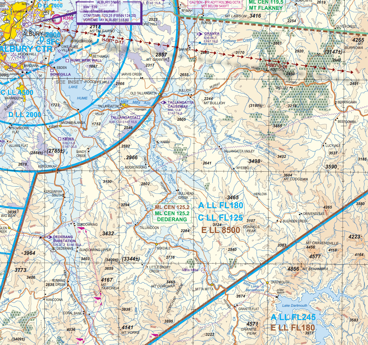
ALBURY [YMAY] Takeoff
elev : 539
rwy : 07ns/25 asphalt
CTAF/TWR : 123.25 (FSINN 124.20)
VOR/DME : AY ALBURY 115.60 -
GRANYA [GRAA] Overfly - H-087° D-17.6 nm
-
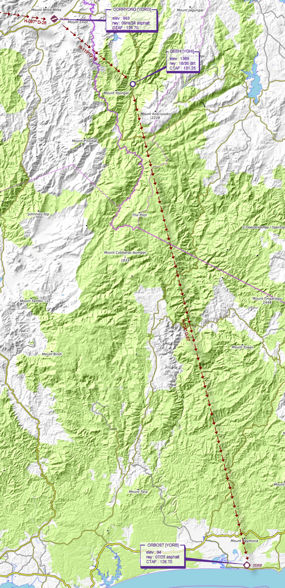
CORRYONG [YCRG] T&G - H-087° D-28.2 nm
elev : 963
rwy : 06ns/24 asphalt
CTAF : 126.70 -
GEEHI [YGHI] T&G - H-119° D-18.3 nm
elev : 1389
rwy : 18/36 dirt
CTAF : 131.25 -
ORBOST [YORB] Land - H-154° D-87 nm
elev : 94
rwy : 07/25 asphalt
CTAF : 126.70
Albury VTC
WAN Chart